
Is Canada south of Detroit? Yes. Downtown Detroit sits on the north bank of the Detroit River, and Windsor, Ontario, is on the south bank, so when you look across the water from Hart Plaza, you are looking south into Canada. The river that separates them is only about a third to half a mile wide downtown.
How deep is the Detroit River? Its main shipping channels are kept about 27.5 to 29 feet deep, and the natural midriver channel past downtown runs 29 to 43 feet deep, according to NOAA. Near shore and around the islands, it can be just a few feet deep.
Detroit River quick facts
- Direction to Canada from downtown: South (Windsor, Ontario)
- Width downtown: About 0.35 to 0.5 mile
- Shipping channel depth: About 27.5 to 29 ft
- Midriver depth past downtown: 29 to 43 ft
- Crossings: Detroit-Windsor Tunnel, Ambassador Bridge, Gordie Howe International Bridge
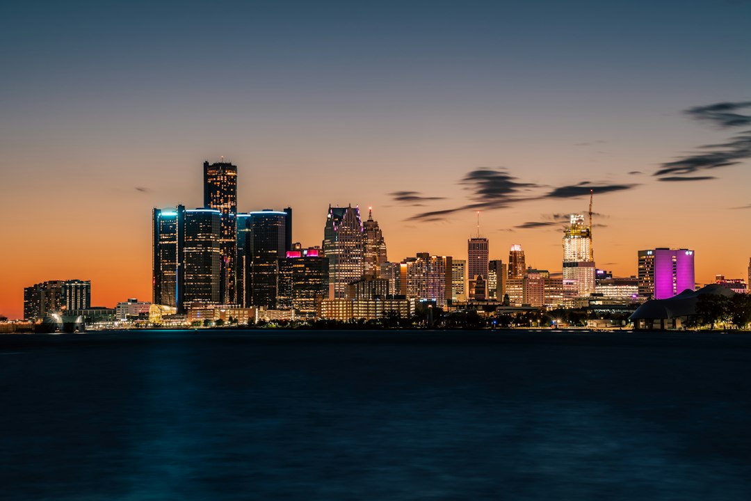
This guide explains why the border runs the “wrong” way, how deep the Detroit River really is, how far Canada is from Detroit by each crossing, and why locals warn people never to try swimming it.
Last updated: Oct. 24, 2026. Depth and width figures come from NOAA’s U.S. Coast Pilot 6, the federal navigation guide for the Great Lakes.
- Why Canada is south of Detroit
- How deep is the Detroit River?
- How far is Detroit from Canada?
- Why is the Detroit River so dangerous?
- What you need to cross into Windsor
- FAQ
Why is Canada south of Detroit?
Canada is south of Detroit because of the direction the Detroit River flows. Most of the U.S.-Canada border runs east to west, with Canada to the north. Here, though, the border follows the river, and the Detroit River runs between Lake St. Clair and Lake Erie. Through downtown, it bends so that it flows roughly from east to west. That puts Detroit on the north shore and Windsor on the south shore.
The result is a famous piece of trivia: from downtown Detroit, you drive south across the Ambassador Bridge or through the tunnel to reach Canada. It is one of very few spots on the border where a Canadian city sits directly south of an American one, and it is the best known of them.
Farther downriver the bend straightens toward the south, so communities such as Wyandotte and Grosse Ile face Ontario towns to the east instead. For the basics on where Detroit sits within Michigan, see our Detroit, Michigan at-a-glance guide.
How deep is the Detroit River?
The Detroit River’s main shipping channels are kept about 27.5 to 29 feet deep, and the natural midriver channel between Fighting Island and Belle Isle runs 29 to 43 feet deep, according to NOAA’s U.S. Coast Pilot 6. The deepest point, about 53 feet, is in the northern part of the river. Close to shore and around the islands it can be much shallower. In some places, shoals sit only a few feet below the surface.
The “project depths” in the table below are the depths the federal government maintains for freighters. They are not the river’s natural floor, and they are measured from a fixed low-water reference, so actual water can be deeper when lake levels run high.
| Part of the river | Depth | What it means |
|---|---|---|
| Fleming Channel (south of Belle Isle) | 27.5 to 28.5 ft | Main dredged channel at the Lake St. Clair end |
| Midriver, Fighting Island to Belle Isle | 29 to 43 ft | Natural deep water past downtown Detroit and Windsor |
| Over the Detroit-Windsor Tunnel | About 38 ft (midchannel) | Water above the tunnel roof, per NOAA’s 2022 survey |
| Livingstone and Amherstburg channels | 21 to 29 ft | Dredged freighter lanes in the lower river |
| Deepest point | About 53 ft | Northern portion of the river |
| Shoals near Belle Isle and the islands | 1 to 6 ft in spots | Hazards for small boats |
Depth also changes with the weather. NOAA warns that strong east or west winds can raise or lower water levels in the lower river by as much as 6 feet within eight hours.
How long and wide is the Detroit River?
The river runs about 28 to 32 miles from Lake St. Clair to Lake Erie, depending on where you start measuring. NOAA’s Coast Pilot uses 32 miles, measured between the navigation lights at each end. Past downtown Detroit, it is only about 0.35 to 0.5 miles wide. In the island-filled lower river, it widens to as much as about 2.5 miles. On average, about 190,000 cubic feet of water flows through it every second.
How far is Detroit from Canada?
Canada is less than a mile from downtown Detroit. Across the river from the Renaissance Center, the Windsor shoreline is roughly a third to half a mile away. You can see it plainly from the Detroit RiverWalk. How far you actually travel depends on the crossing you use:
| Crossing | Opened | Length | Notes |
|---|---|---|---|
| Detroit-Windsor Tunnel | 1930 | 5,160 ft (about 1 mile) | Downtown to downtown; about 75 ft below the surface at its deepest |
| Ambassador Bridge | Nov. 15, 1929 | 7,490 ft (about 1.4 miles) | 1,850-ft main span; privately owned |
| Gordie Howe International Bridge | July 27, 2026 (vehicles); Aug. 5, 2026 (walking and cycling path) | About 1.6 miles | Newest crossing, from Detroit’s Delray neighborhood; links I-75 to Ontario’s Highway 401; the path is toll-free |
Driving time is usually set by border inspection, not distance. On a quiet day, the crossing itself can take a few minutes. At rush hour or on holiday weekends, the wait can be much longer, so check the border wait times the bridge and tunnel operators post before you leave. Windsor is also on Eastern Time, so Detroit’s time zone applies on both sides of the river.
Why is the Detroit River so dangerous?
The Detroit River is dangerous because it is deep, fast, cold for much of the year and busy with freighters. It looks calm from shore, but it is a working shipping channel connecting the upper and lower Great Lakes, not a swimming spot.
- Steady current: NOAA lists currents of about 1.2 to 1.6 mph near the Ambassador Bridge and Belle Isle and notes that midstream current usually runs about 1.5 times the river’s average velocity. That is enough to tire even a strong swimmer and carry them far downstream.
- Sudden drop-offs: Water can go from waist-deep near a shoal to 30 or 40 feet deep in the channel.
- Big ships: Lake freighters can’t stop or turn quickly, and their wakes and propeller wash affect the water around them.
- Cold water: Outside of summer, cold water can quickly cause cold shock and exhaustion, even close to shore.
- High-water years: In July 2019, when lake levels were very high, the Windsor Port Authority warned that the river was moving at nearly double its usual speed and was too dangerous for swimming, Michigan Public reported.
If you are boating, wear a life jacket and stay clear of the marked freighter channels. If someone goes into the water, call 911 instead of jumping in after them.
What you need to cross from Detroit into Windsor
Even though Canada is minutes away, it is an international border. To return to the U.S. by land, U.S. citizens need a document that meets the Western Hemisphere Travel Initiative, according to U.S. Customs and Border Protection:
- A U.S. passport or passport card, an enhanced driver’s license, or a trusted traveler card (NEXUS, SENTRI, or FAST).
- U.S. citizen children under 16 need only proof of citizenship, such as a birth certificate. The limit rises to under 19 for children traveling with a school, religious or youth group.
- Visitors who are not U.S. citizens should check Canadian and U.S. entry rules for their nationality before going.
See the river’s history up close
The narrow river has shaped Detroit’s story since Antoine de la Mothe Cadillac built a fort on its bank in 1701 (read who founded Detroit). It was the last crossing to freedom on the Underground Railroad, and during Prohibition it became a major route for smuggled liquor. To learn more about the river’s freighters and shipwrecks, the Dossin Great Lakes Museum on Belle Isle is a good place to start. It is listed in our guide to the best museums in Detroit.
Frequently asked questions about the Detroit River and Canada
Can you see Canada from Detroit?
Yes. Windsor’s skyline and riverfront are clearly visible from the Detroit RiverWalk, Hart Plaza, and Belle Isle, less than a mile away across the river.
Can you walk from Detroit to Canada?
Yes, on the Gordie Howe International Bridge, whose multi-use path for pedestrians and cyclists opened Aug. 5, 2026. Check the bridge’s official site for hours and border rules. The Detroit-Windsor Tunnel and the Ambassador Bridge are for vehicles only; foot travelers there typically use the Tunnel Bus.
How deep is the Detroit River at the tunnel?
NOAA’s 2022 survey found about 38 feet of water above the Detroit-Windsor Tunnel at midchannel. At its deepest, the tunnel lies about 75 feet below the river’s surface.
Does the Detroit River freeze?
Ice forms along the shores and in the lower river in cold winters. Because the current keeps moving, ice in the shipping channel is unreliable, and no one should ever walk on it.
The bottom line: Canada really is south of Detroit
Because the Detroit River bends, Windsor, Ontario, lies directly south of downtown Detroit, less than a mile away. The river between them is 29 to 43 feet deep in the middle; its freighter channels are kept about 27.5 to 29 feet deep, and its steady current and shipping traffic make it no place to swim. To visit, take the tunnel or one of the two bridges and bring a passport or another accepted document.
Sources: NOAA U.S. Coast Pilot 6, Ch. 7 (Detroit River); ASCE (Detroit-Windsor Tunnel); Historic Detroit (Ambassador Bridge); ClickOnDetroit (Gordie Howe Bridge opening, July 27, 2026); WNEM and CP24 (bridge walking and cycling path, Aug. 5, 2026); U.S. CBP WHTI fact sheet; Michigan Public.
Leave a Reply